2008-07-04

The Tour de France on Google Maps with Street View


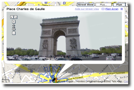
The tour de France 2008 can be followed on Google Maps with panoramic images of the route provided by the Street View feature.


clipped from www.letour.fr
carte du parcours global du Tour de France

Tour de France 2008

Running from Saturday July 5th to Sunday July 27th 2008, the 95th Tour de France will be made up of 21 stages and will cover a total distance of 3,500 kilometres.

clipped from blogoscoped.com

Google Street View Live in France

Google Street View – those panorama photos part of Google Maps – has now been released for France, as second country in the world after the US. However, the pics taken are just from the Tour de France route, as Luka from the French Zorgloob blog explains. The faces of people are blurred as they are in other Street View locations nowadays, Luka explains.

clipped from maps.google.fr
Accéder à la page d'accueil Google Maps
clipped from www.zorgloob.com


Google StreetView en France !

Le tour de France par Google maps

blog it


Related:
TagTélé - Parcours Tour de France 2008
Tour de France - 2008
Google Street View Live in France
Google Maps
Tour de France - Live Tracker
Zorgloob - Tout savoir sur Google... ou presque !
Google Maps Mania: The Tour de France on Google Maps
Tour de France - Wikipedia, the free encyclopedia